Four Corners Monument is not in the wrong place
The number, and why NOAA has published three of them
Start with the one thing everybody agrees on: there is a gap. The marker does not sit on the line the nineteenth-century statutes described. How big the gap is depends on who you ask inside the same agency.
NGS’s page hedges that the offset “is in fact only about 1800 feet, or less.” A NOAA podcast with Doyle gives a range of roughly 1,350 to 1,800 feet. Doyle himself has been quoted at 1,807.14 feet, to the hundredth of a foot. Three figures, one agency, and they do not reconcile.
They do not reconcile because the answer depends on which historical value of the Washington meridian you adopt, and there is more than one. NGS has never published which constant Doyle used, so his 1,807.14 cannot be independently reconstructed from anything public. That is why this page reports a range and hangs the precise number on the man who produced it. If you find a site stating one exact offset as plain fact, with no name attached, it has copied a figure it cannot source.
The meridian nobody reads: the 32nd west from Washington
The reason for the gap is arithmetic, and it is not the surveyors’ arithmetic.
The statutes never said 109 degrees west of Greenwich. The Colorado Organic Act of 28 February 1861 bounded the new territory by the 25th and 32nd meridians west from Washington — meaning the Old Naval Observatory in Washington, DC, which an Act of 28 September 1850 had made the American prime meridian and which stayed the American prime meridian until 1912. Convert that described line using a modern value for the Washington meridian and it falls about 1,800 feet west of where the monument stands.
That wording is not a museum piece. It is still quoted verbatim in Article I of the Colorado Constitution today, and Article I of New Mexico’s Constitution still defines that state’s western boundary as “the thirty-second meridian of longitude west from Washington.” A prime meridian that was repealed in 1912 is still doing work in two state constitutions.
The Arizona Organic Act of 24 February 1863 (12 Stat. 664), signed by Lincoln, went further and made the surveyor’s work the definition. It runs Arizona’s eastern line due south “from the point where the southwest corner of the Territory of Colorado joins the northern boundary of the Territory of New Mexico.” Read that slowly. Arizona’s eastern boundary is legally defined as starting from wherever Colorado’s corner turned out to be. Not from a longitude. From a corner.
Where “2.5 miles off” comes from, and why it is wrong
The claim is everywhere, and it has one source: assuming the statutes meant Greenwich. Measure the marker against 109°00′ west of Greenwich and you get 2.498 miles, west. Round it and you have the number a hundred travel articles print.
The trouble is that the statutes did not mention Greenwich, the United States was not using Greenwich when they were written, and the line the acts describe is not the line that measurement is taken from. It is a real distance to a real meridian that no statute ever named. Put the two side by side: 2.498 miles is about 13,190 feet, and the offset that actually exists is under 1,800. The myth is roughly seven times the size of the thing it claims to describe.
East. Not west.
Direction is the second thing travel writing reverses, and it is reversed roughly as often as it is right. Two statements, both true, and they point opposite ways because they are measured from different things:
- The marker is east of the 32nd meridian west from Washington — the line the statutes actually describe.
- The marker is west of 109°W measured from Greenwich — the line the statutes never mentioned.
Anyone who writes that the monument sits west of where it should be has taken the Greenwich sentence and applied it to the Washington question.
Two surveyors, two monuments, and two numbers that must not be mixed
Ehud N. Darling surveyed the 37th parallel as the Colorado–New Mexico line in 1868 and set a monument where he took the meridian to be. Seven years later Chandler Robbins, under contract to the General Land Office, established the corner on 10 July 1875. The contemporary description of what he put in the ground is worth having: “a shaft of hard sandstone, 7 feet long, 12 inches wide and 6 inches thick; set 3 feet in the ground.”
Robbins set his corner 1 mile 45 chains east of Darling’s monument. A chain is 66 feet, so 45 chains is 2,970 feet and the whole distance is about 1.56 miles. Later work showed the error was Darling’s, not Robbins’s.
Now the part that gets mangled. That 1 mile 45 chains measures one surveyor’s monument against another surveyor’s monument. The 1,300 to 1,800 feet in the section above measures the standing marker against the statutory meridian. Different quantities, different reference objects, produced by different methods for different purposes. They cannot be added, subtracted, averaged or swapped, and an article that slides from one to the other inside a paragraph has stopped describing anything real. Keep them in separate boxes and the story stays straight.
Two more corrections while we are here. There is no 1868 Act of Congress fixing this longitude, whatever you have read; 1868 is the year of Darling’s survey, the statutes are 1861 and 1863, and NGS’s own page cites 1863. And the corner did not stop being surveyed in 1875: Rollin J. Reeves ran the Colorado–Utah line in 1878 and Howard B. Carpenter the Arizona–Utah line in 1901. The plaque on site names all four men, and records restorations in 1899, 1931, 1962 and 1992.
Why the marker is the legal corner
Here is where the whole “wrong place” framing collapses. In American boundary law the monument on the ground outranks the description in the statute. Four supports, in ascending order of authority.
One. NGS’s page on this is titled “Why the Four Corners Monument is in Exactly the Right Place.” It states that once a monument has been established and accepted by the parties involved, “the location of the physical monument is the ultimate authority in delineating a boundary,” and that this monument “does indeed correctly mark the four-state-intersection point.”
Two. Doyle, on the record and without hedging: “Even if it’s 10 miles off, once it’s adopted by the states … the numerical errors are irrelevant. It becomes the legal definition.”
Three. The US Supreme Court settled the principle in New Mexico v. Colorado, 267 U.S. 30, decided 26 January 1925. New Mexico sued to replace Darling’s 1868 line with a more accurate 1903 resurvey. New Mexico lost. The Court decreed the Darling line to be the boundary and held that “governments are bound by the practical line that has been established as their boundary, although not precisely a true one.” A state went to the Supreme Court arguing that a more accurate line should win, and was told that accuracy was not the test.
Four. Colorado writes it into its own statute books. The editor’s note to Article I reads: “As a result of a survey that was performed in the 1800’s, the actual boundaries of the state of Colorado differ from the legal description…” and cites New Mexico v. Colorado. The state knows its edges are not where its constitution says, and has said so in print.
Underneath all four sits 43 U.S.C. § 752: “The boundary lines, actually run and marked in the surveys returned … shall be established as the proper boundary lines.” Run and marked. Not described.
The 1925 case is the one that matters here for a reason people miss: the line New Mexico was attacking is the Colorado–New Mexico boundary, the 37th parallel, and that is the line running due east and west through this marker. It is not a distant analogy. It is the horizontal line under your feet when you straddle the disc.
The one thing I will not claim
No court has ever ruled on the quadripoint itself. The 1925 case concerns the line that runs through it, not the point. So the accurate phrasing is that the corner has never been challenged — not that it has been upheld. That distinction costs the argument nothing and it is the difference between a page you can trust on the rest and one you cannot.
What follows from all of it is simple enough. Arizona, Colorado, New Mexico and Utah meet where the monument says they meet, because the monument is what they agreed to. If a modern survey found the marker somewhere none of the four expected, the four states would still meet at the marker.
What this looks like when you are standing on it
Nothing, is the honest answer. The plaza sits at about 4,861 feet — a USGS elevation query returns 4,860.92 ft at the point, and an NGS mark 170 meters east reads 4,852 ft. The center marker is a disc set in granite, installed in 1992 by the Bureau of Land Management according to the plaque; the original 1912 marker was a plain cement pad. You cannot see 1,800 feet of geodetic history from the middle of it, and the four states do not look any different on either side of the lines.
I like the story anyway. It is the rare tourist attraction whose actual subject is a legal principle, and the principle is a good one: a boundary is where the people who share it agreed to put a rock, and the rock wins. Admission is US$8 per person at the gate, paid on arrival, on Navajo Nation land. There is no advance ticket and nobody sells one.
Bookable near the marker, and going nowhere near it
Nothing on any booking platform visits Four Corners Monument, so nothing below does either. These are the three nearest bookable things to the drive, all at Mesa Verde about 49 road miles east. Two of them mention Four Corners in their own copy and both mean a viewpoint over the region, tens of miles from the quadripoint. The marker itself is self-drive and US$8.
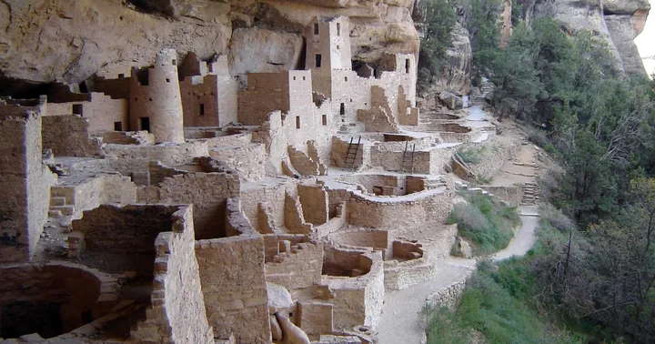 Nearest & cheapest
Mesa Verde: 700 Years Tour & Ranger-Guided Cliff Palace Visit
 Sees all four statesPark entry included
Mancos: Mesa Verde National Park Half-Day Tour
 Best rated herePark entry + lunch included
Durango: Mesa Verde National Park, Cliff Palace Tour with Lunch
The rest of it: the four states and what you do on the disc, where the name comes from, the complete guide.
Frequently asked questions
How far is the Four Corners Monument from the actual four corners?
Roughly 1,300 to 1,800 feet east of the meridian the founding statutes describe. Dave Doyle, then Chief Geodetic Surveyor at NOAA’s National Geodetic Survey, put it at 1,807.14 feet; NGS’s own page says about 1,800 feet or less, and a NOAA podcast with Doyle gives 1,350 to 1,800. The figures differ because they depend on which historical value of the Washington meridian you use.
Why is the Four Corners Monument not accurate?
Because the 1861 and 1863 statutes fixed the line as the 32nd meridian west from Washington, DC — the American prime meridian from 1850 to 1912 — and converting that description with modern values lands it about 1,800 feet west of the marker. It is a conversion gap, not a blunder, and it does not move the legal corner.
What is the controversy surrounding the Four Corners Monument?
There is less to it than the headlines suggest. The widely repeated claim that the monument is 2.5 miles off comes from measuring against Greenwich, which no statute ever named. NGS titles its page on the subject “Why the Four Corners Monument is in Exactly the Right Place,” and the US Supreme Court held in New Mexico v. Colorado, 267 U.S. 30 (1925) that governments are bound by the practical line established as their boundary. New Mexico brought that case and lost.
What is unusual about the US Four Corners?
It is the only point in the United States where four states meet, and the only US quadripoint. The corner exists because nineteenth-century surveyors ran lines from a prime meridian in Washington, DC that Congress repealed in 1912 — wording still carried in Article I of both the Colorado and New Mexico constitutions. One caveat kept straight: the quadripoint itself has never been litigated, so it has never been challenged rather than upheld.